
| Seal |
| This parish of Seal has, in the upper part of it, much waste ground in it, which is a dreary barren land, consisting in this and the adjoining parishes eastward, of several hundred acres, being in general covered with heath and furze, with some scrubby wood interspersed among the hills, which are high, and some of them of large extent; the soil in the middle part of the parish is Kentish rock stone, and below that very rich and fertile. It is computed to contain about three thousand acres of land. The high road from Westerham, over Wrotham heath, to Maidstone, leads across this parish; on which, near the eastern boundary of it, is the village of Seale, having the church on the north side of it; and near the western boundary, on the same road, is a large hamlet, called Seale Chart, about half a mile northward of which is the old seat of Stonepit; and about as far on the other side that of Diggin's, now called the Grove, the residence of Mrs. Harding, widow of Nicholas Harding, esq. and sister to the late Charles Earl Camden; beyond which is Hall-place, situated among the coppice woods, where there are the several commons of Godding-green, Falk-common, and Beechet-green; the parish extending here with a nook southward, as far as Under River. The parish of Sevenoke comes up as far as the grounds of Wilderness, which is situated only a small distance southward of Seale village, and likewise bounds it towards the west. There is a fair held here on June 6, for pedlary and toys. extract from Hasted's History of Kent published in 1797 |
| Books and other documents | |
| Published | Title, author and references |
| 1797 | The History and Topographical Survey of the County of Kent - Volume III by Edward Hasted ⇒ p. 51 |
| 1839 | Directory of Kent, Surrey & Sussex ⇒ entry |
| 1840 | New Guide for Tunbridge Wells by John Colbran and edited by James Phippen ⇒ p. 376 |
| 1882 | Kelly's Directory of Kent by E. R. Kelly, M.A., F.S.S. ⇒ entry |
| 1914 | Highways and Byways in Kent by Walter Jerrold with Illustrations by Hugh Thomson ⇒ p. 358 |
| Pictures | |||||||
 Wildernesse Avenue - 1906 | 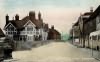 Church Street - 1907 | 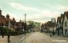 The Street - 1907 | 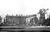 Wildernesse - 1909 | 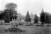 Wildernesse - 1909 | 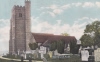 Seal Church - c 1920 | ||
|
'
| |||||||||||||
The Weald is at Database version 14.05 which has ongoing updates to the 395,000 people; 9,000 places; 613 maps; 3,308 pictures, engravings and photographs; and 248 books loaded in the previous version


