| Heathfield |
| Parish & other records | Before 1500 |
1500 to 1550 |
1550 to 1600 |
1600 to 1650 |
1650 to 1700 |
1700 to 1725 |
1725 to 1750 |
1750 to 1775 |
1775 to 1800 |
1800 to 1825 |
1825 to 1850 |
1850 to 1875 |
1875 to 1900 |
1900 to 1925 |
1925 to 1950 |
1950 to 1975 |
1975 to 2000 |
After 2000 |
||
| 5863 | Births | 22 | 82 | 96 | 46 | 76 | 191 | 413 | 977 | 1933 | 1365 | 630 | 32 | |||||||
| 2188 | Christenings | 22 | 78 | 97 | 43 | 74 | 166 | 258 | 551 | 503 | 221 | 149 | 26 | |||||||
| 339 | Marriages | 2 | 22 | 36 | 14 | 21 | 32 | 49 | 72 | 76 | 8 | 6 | 1 | |||||||
| 331 | Deaths | 2 | 7 | 7 | 10 | 21 | 28 | 20 | 40 | 58 | 80 | 48 | 3 | 6 | 1 | |||||
| 320 | Burials | 2 | 7 | 7 | 10 | 18 | 18 | 19 | 38 | 61 | 83 | 50 | 3 | 4 | ||||||
| Books and other documents | |
| Published | Title, author and references |
| 1835 | The History, Antiquities and Topography of the County of Sussex by Thomas Walker Horsfield, F.S.A. ⇒ p. 573 |
| 1840 | New Guide for Tunbridge Wells by John Colbran and edited by James Phippen ⇒ p. 180 |
| 1849 | Historical and Architectural Notices of the Iron Works of the County of Sussex by Mark Antony Lower ⇒ p. 210 |
| 1870 | A Compendious History of Sussex - Volume I. by Mark Antony Lower, M.A. ⇒ p. 225 |
| 1882 | Kelly's Directory of Sussex by E. R. Kelly, M.A., F.S.S. ⇒ entry |
| 1904 | Highways and Byways in Sussex by E.V. Lucas ⇒ p. 307 |
| 1927 | The Sussex Highlands ⇒ p. 49 |
| Heathfield Maps | |||||||
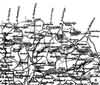
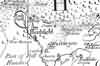 c 1724 | 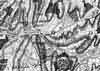 c 1795 | 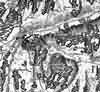 c 1825 | |||||
| Sussex Maps | |||||||
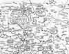 1610 | 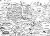 1645 | 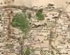 1695 | 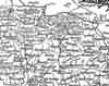 1763 | 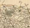 1st Sept 1787 | 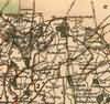 1808 | 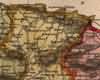 1837 | |
 1840 | 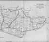 1864 | ||||||
| Places and properties in Heathfield - a directory of homes, farms, churches, schools, inns, and other places of interest that existed prior to 1900 has been compiled from Post Office directories, Kelly's directories, Trade directories, Census data, Ordnance survey maps and books of the period |
The Weald is at Database version 14.05 which has ongoing updates to the 395,000 people; 9,000 places; 613 maps; 3,308 pictures, engravings and photographs; and 248 books loaded in the previous version