
| Teston |
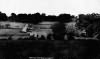
| Teston is vulgarly called Teeson. In the book of Domeday it is written TESTAN, and in the Textus Roffensis, TERSTANA. This parish is a borough, and has a court leet of itself; where the borsholder is chosen, and the inhabitants of it owe no service to the court leet holden for the hundred of Twyford; but a constable for that hundred may be chosen there out of this borough. TESTON is beautifully situated on the side of a hill, declining southward towards the river Medway, which is its southern boundary opposite to West Farleigh. The soil is in general a fertile loam, covering the quarry rock, which at the same time that it is dry and healthy, is exceeding kindly for corn, fruit and hop plantations. The high road from .Maidstone towards Watringbury and Tunbridge, leads along the lower part of this parish, between which and the river the neat kept grass lands, separated from the road by a handsome white railed fence, have a very, pleasing effect. Hence the road branches off, to the right to Ofham and Town Mailing, and to the left to Cocks heath, Yalding, and the Weald, across the river, over which there is here a lofty stone bridge of seven arches, which, notwithstanding its height, is frequently rendered impassable from the sudden overflowings of the river, which here at times frequently rises near eighteen feet above its usual surface, in the space of twenty-four hours, and as quickly falls again, unless it is again augmented by repeated rains. Teston park pales adjoin the northern side of the Maidstone road, hence the park rises to Teston-house, which being of white stucco, is a conspicuous object to the neighbouring country, and with the adjoining grounds, some years since, were greatly ornamented and laid out in the modern taste by Mrs. Bouverie; at the back of the house the ground keeps rising, and the park which is well covered with fine large trees, as well as modern plantations of various sorts, extends to the woods, which are remarkably well filled with large oak trees, and to East Malling heath, but in these parts it is more wet and deeper soil, and less fertile than the more southern parts of this parish extract from Hasted's History of Kent published in 1798 |
| Parish & other records | Before 1500 |
1500 to 1550 |
1550 to 1600 |
1600 to 1650 |
1650 to 1700 |
1700 to 1725 |
1725 to 1750 |
1750 to 1775 |
1775 to 1800 |
1800 to 1825 |
1825 to 1850 |
1850 to 1875 |
1875 to 1900 |
1900 to 1925 |
1925 to 1950 |
1950 to 1975 |
1975 to 2000 |
After 2000 |
||
| 14 | Births | 1 | 2 | 1 | 2 | 7 | 1 | |||||||||||||
| 3 | Christenings | 1 | 2 | |||||||||||||||||
| 1 | Marriages | 1 | ||||||||||||||||||
| 1 | Deaths | 1 | ||||||||||||||||||
| 1 | Burials | 1 | ||||||||||||||||||
| Books and other documents | |
| Published | Title, author and references |
| 1798 | The History and Topographical Survey of the County of Kent - Volume V by Edward Hasted ⇒ p. 126 |
| 1882 | Kelly's Directory of Kent by E. R. Kelly, M.A., F.S.S. ⇒ entry |
| 1914 | Highways and Byways in Kent by Walter Jerrold with Illustrations by Hugh Thomson ⇒ p. 283 |
| Pictures | |||||||
 Teston Bridge and Halt - 1916 |  Teston Lock - 1919 | ||||||
| Places and properties in Teston - a directory of homes, farms, churches, schools, inns, and other places of interest that existed prior to 1900 has been compiled from Post Office directories, Kelly's directories, Trade directories, Census data, Ordnance survey maps and books of the period |
|
|
|
|
The Weald is at Database version 14.05 which has ongoing updates to the 395,000 people; 9,000 places; 613 maps; 3,308 pictures, engravings and photographs; and 248 books loaded in the previous version


