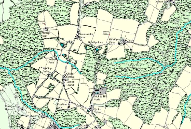
| Cooks Corner, Gillridge, Parkgrove & Royal Mires, North of Crowborough - c 1875 |
| Computer enhanced version of the Ordnance Survey First Edition 1875 Map - image produced with permission of Ordnance Survey |
|
Size control: Medium ►►► Zoom control: Year control: |
|
The Weald is at Database version 14.05 which has ongoing updates to the 395,000 people; 9,000 places; 613 maps; 3,308 pictures, engravings and photographs; and 248 books loaded in the previous version