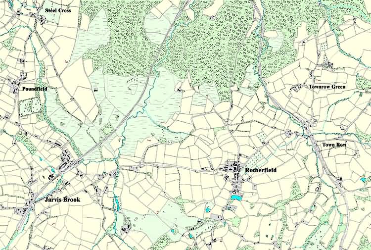
| Rotherfield, Sussex - c 1899 |
| Computer enhanced version of the Ordnance Survey Second Edition 1899 Map - original maps available from Ordnance Survey Historical Mapping Surveyed in 1872-3 and revised in 1897 Size is 3 miles by 2 miles |
|
Size control: Medium ►►► Zoom control: Year control: |
|
The Weald is at Database version 14.05 which has ongoing updates to the 395,000 people; 9,000 places; 613 maps; 3,308 pictures, engravings and photographs; and 248 books loaded in the previous version