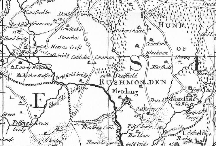
| Fletching and Marefield, Sussex - c 1724 |
| Part of the 1 inch to 1 mile map of Sussex produced in 1724 by Richard Budgen (1695-1731). The map was dedicated to The Rt Hon Spencer Compton as (amongst other titles) Knight of the Shire for the County of Sussex, was engraved by John Senex and printed for Henry Lintot at Cross Keys, London The map can rightly claim to be the first large scale map of Sussex. It incorporated much new information including the location of many iron furnaces and forges for more information refer to Printed Maps of Sussex, 1575-1900 by D. Kingsley, published by the Sussex Record Society The width of the image below is approximately 6 miles |
|
Size control: Medium ►►► Zoom control: Year control: |
|
The Weald is at Database version 14.05 which has ongoing updates to the 395,000 people; 9,000 places; 613 maps; 3,308 pictures, engravings and photographs; and 248 books loaded in the previous version