
| Historical notes about East Hoathly |
| c 1400 | History | East Hoathly | Horsfield's Sussex | ||
| At a very early period, the ancestors of the noble house of Chichester had considerable possessions in this and the neighbouring parish of Laughton. In the year 1400, Johannes Pelham, of Laughton, together with Nicholaus Carewe, were sheriffs of Surrey and Sussex; but how long, previously to this date, he or his ancestors had property in the district, is uncertain. | |||||
| c 1525 | History | East Hoathly | Horsfield's Sussex | ||
| In 16th Henry VIII., William Pelham obtained from the king a grant of free warren in all his lands at Hoathleigh. | |||||
| 1610 | ![[North] Sussex](images/t/Speed1610E.jpg) | [North] Sussex by John Norden and augmented by John Speed | E. Hoadly | John Speed | |
| The first engraved maps of the counties of Great Britain were the work of Christopher Saxton who, under the authority of the Privy Council, surveyed the English counties in Elizabethan times, from 1574 to 1578. In 1593 he was followed by John Norden who projected an ambitious scheme for a complete series of county histories. He published before his death a number of counties - Middlesex, Hertfordshire, Essex, Northampton, Cornwall, Sussex and Surrey. John Speed's map of Sussex is based upon Norden's map and was engraved by Jodocus Hondius. It occupies pages nine and ten of John Speed's Atlas entitled "The Theatre of the Empire of Great Britaine", is 20 1/4 inches by 15 1/4 inches in size and shows additionally an interesting plan of Chichester and a spirited representation of the Battle of Hastings. | |||||
| 1645 | ![[North] Sussex](images/t/Blaeu1645E.jpg) | [North] Sussex by Jan Blaeu | E. Hoadly | Jan Blaeu | |
| 1695 | ![[North] Sussex](images/t/Morden1695E.jpg) | [North] Sussex by Robert Morden | East Hoadly | Robert Morden | |
| Robert Morden was a London bookseller from 1669 until his death in 1703. He specialised in the geographical field and was himself something of a cartographer and a publisher. Throughout the 17th and most of the 18th centuries, there was little distinction between the activity of book or print-selling and that of publishing: many booksellers were also printers or engravers. They undertook the sale of each others' work and often combined to meet the high cost of publishing a new map or reissue of an old atlas, even if the original plates were still available. This map was published in Brittania: a chorographical description of Great Britain and Ireland by William Camden. | |||||
| c 1724 | 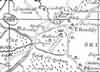 | Part of the 1 inch to 1 mile map of Sussex produced in 1724 by Richard Budgen | East Hoathly | ||
| 1750 | 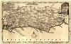 | Sussex by Thomas Kitchin | E. Hoathly | Thomas Kitchin | |
| Thomas Kitchin, an engraver and publisher from c.1738 to 1776, held the appointment of Hydrographer to the King. His output was prolific. He engraved the maps of the British and French dominions in North America by John Mitchell (1755), which was used at the peace coucil at the end of the revolutionary war. In his later years he worked with his son (hence senior after his name in the c.1755 edition of the Small English Atlas). He died in 1784. | |||||
| 1763 | ![A New Map of [North] Sussex](images/t/Kitchin1763E.jpg) | A New Map of [North] Sussex by Thomas Kitchin | E. Hoathley | Thomas Kitchin | |
| Thomas Kitchin, an engraver and publisher from c.1738 to 1776, held the appointment of Hydrographer to the King. His output was prolific. He engraved the maps of the British and French dominions in North America by John Mitchell (1755), which was used at the peace coucil at the end of the revolutionary war. In his later years he worked with his son (hence senior after his name in the c.1755 edition of the Small English Atlas). He died in 1784. | |||||
| 18th Nov 1768 | Diary entry | East Hoathly | Thomas Turner's Diary | ||
| One record more he left, and that is an account of the stately funeral of the Duke of Newcastle, who was interred in the family vault at Laughton, on Nov. 18, 1768. "Atchievements very large, embellished and emblazoned,, were placed on Newcastle House and Clearmont House ; two more, of smaller size, on Halland House and Bishopstone House." Twenty-four escutcheons, twelve stars with garters, twelve crests, and a very large ducal coronet, glittered among the funeral trappings. The Bishop of Norwich read the service; four mourning coaches, each drawn by 11 six full-tailed horses, "followed the hearse, which 11 was finely dressed with escutcheons, pendants, shields, starrs and garters, and banners," but with the exception of the first, in which sat John Pelham, Esq., chief mourner, the Bishop of Norwich in his rocket, the Rev. Dr. Hurdis, his Grace's chaplain, and the Rev. Mr. Thomas Hurdis, they were all filled with domestic servants. "His Grace's tenants and the principal inhabitants of East Hothly and Laughton, as also many others of the adjoining parishes, on horseback, two and two, closed the procession;" but not one of the many noble and gentle guests who, as we have seen, had been so often partakers of his noisy but splendid hospitality, followed to the grave the remains of the first and last Duke of Newcastle of the ancient line of Pelham. | |||||
| c 1785 | 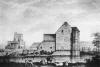 | Laughton Place, East Hoathly by Samuel Hieronymus Grimm | Samuel Hieronymus Grimm, topographical artist | The Burrell Collection | |
| 1st Sep 1787 | ![[North] Sussex](images/t/Cary1787E.jpg) | [North] Sussex by John Cary | E. Hoathly | John Cary | |
| John Cary, apprenticed to William Palmer in 1770, went into business in 1783 as a publisher of maps, plans and road-books. He was highly successful and is referred to as the founder of the modern English School of Cartography by H.G. Fordham | |||||
| c 1795 | 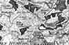 | Part of the 1 inch to 1 mile map of Sussex produced in 1795 by William Gardner and Thomas Gream | East Hoathly | ||
| 1808 | ![[North] Sussex](images/t/Cole1808E.jpg) | [North] Sussex by G.Cole and engraved by J.Roper | E. Hoathly | G. Cole | |
| The British atlas; comprising a series of county maps…intended to illustrate and accompany 'The beauties of England and Wales' published 1808. | |||||
| c 1825 |  | Part of the 1 inch to 1 mile map of Sussex produced in 1825 by Christopher and John Greenwood | East Hoathly | ||
| 1837 | ![[North] Sussex](images/t/Moule1837E.jpg) | [North] Sussex by Thomas Moule | East Hoathly | Thomas Moule | |
| Thomas Moule was a bookseller. He published a number of important works on heraldry and antiquities, including Bibliotheca heraldica Brittaniae in 1822. The English Counties delineated; or, a topographical description of England has a complete series of county maps and was published by Thomas Moule in 1837 | |||||
| 1840 | ![[North] Sussex](images/t/Dugdale1840E.jpg) | [North] Sussex by Joshua Archer, Pentonville, London | East Hoathly | Dugdale | |
| Dugdale's England and Wales Delineated | |||||
| 6th Jun 1841 | Census | East Hoathly | 1841 Census East Hoathly, Sussex | ||
| comprising the whole of the Parish of East Hoathly Enumerator - Samuel Southede; Registrar - Henry Holman | |||||
| 1851 | Directory | East Hoathly | Post Office Directory | ||
| EAST HOATHLY is a parish and village, 5 miles from Uckfield south-east, and 8 from Lewes north-east, in the Union of Uckfield, Hundred of Shiplake, and rape of Pevensey. ........ The area is 2,000 acres, the population 607, and the assessment £3,548. | |||||
| 30th Mar 1851 | Census | East Hoathly | 1851 Census East Hoathly, Sussex | ||
| The whole of the Parish of East Hoathly including the Nursery Hamlet and Hawkins Common Enumerator - George Holman | |||||
| 1864 |  | East Sussex with the addition of the Railways by Mark Antony Lower | East Hoathly | Lower's Sussex | |
| Mark Antony Lower, son of Richard Lower, born 14th July 1813 in Heathfield, school master in the early 1830s at East Hoathly, Heathfield and Alfriston; and at Lewes from 1835 to 1867; and at Seaford 1867-1871. He then moved to London where he died in 1876. He was a founder member of the Sussex Archeological Society and a prolific contributor to the collections of the society. He published
| |||||
| 1867 | Directory | East Hoathly | Post Office Directory | ||
| EAST HOATHLY is a parish and village, 5 miles south-east from Uckfield, 8 north-east from Lewes, and 48 by road from London, in the Eastern division of the county, Uckfield union, Shiplake hundred, Lewes county court district, archdeanery and rural deanery, rape of Pevensey and diocese of Chichester. ............... The area is 2,000 acres; the population in 1861 was 615. .................... | |||||
| 1874 | Directory | East Hoathly | Post Office Directory | ||
| EAST HOATHLY is a parish and village, on the road from Uckfield to Hailsham, 5 miles south-east from Uckfield, 8 north-east from Lewes, and 48 by road from London, in the Eastern division of the county, Uckfield union, Shiplake hundred, Lewes county court district, and rape of Pevensey, archdeaconry of Lewes, rural deanery of Chaily and diocese of Chichester. .......... The area is 2,500 acres; gross estimated rental, £3,735; rateable value, £3,067 the population in 1871 was 730. .................. | |||||
| 3rd Apr 1881 | Census | East Hoathly | 1881 Census East Hoathly, Sussex | ||
| Easy Hoathly Village | |||||
| 1882 | Directory | East Hoathly | Kelly's Directory | ||
| EAST HOATHLY is a parish and village, on the road from Uckfield to Hailsham, 5 miles south-east from Uckfield, 8 north-east from Lewes and 48 by road from London, in the Eastern division of the county, Uckfield union, Shiplak hundred, Lewes county court district and rape of Pevensey, rural deanery of Pevensey (No. 3), archdeaconry of Lewes and diocese of Chichester. ................ The area is 2,500 acres; rateable value £3,162 ; the population in 1881 was 857. .............. | |||||
| c 1899 |  | Part of the 6 inch to 1 mile map of Sussex produced in 1899 by Ordnance Survey | East Hoathly | ||
The Weald is at Database version 14.05 which has ongoing updates to the 395,000 people; 9,000 places; 613 maps; 3,308 pictures, engravings and photographs; and 248 books loaded in the previous version


