
| Historical notes about Framfield |
| c 1315 | History | Framfield | Horsfield's Sussex | ||
| The manor of Framfield includes the greater part of the parishes of Uckfield, Buxted, and part of Isfield. In 8th Edward II., the Archbishop of Canterbury held Fremefeld, together with Ranscombe and Ringmer | |||||
| c 1552 | History | Framfield | Horsfield's Sussex | ||
| In 1st and 2nd Philip and Mary, John Levett died seized [of the Manor of Framfield], leaving Lawrence his son next heir. | |||||
| c 1590 | History | Framfield | Horsfield's Sussex | ||
| Framfield was granted by letters patent in the reign of Queen Elizabeth, to Bromley and Branthwaite. In 31st Elizabeth, it was aliened by Richard Branthwaite and another to Sir Thomas Palmer, who, in 34th Elizabeth, aliened it to Thomas Sackville Lord Buckhurst, in whose family it continued till it passed by the marriage of Margaret. daughter of Richard Earl of Dorset, to John Tufton, Earl of Thanet. It was subsequently purchased by the late Duke of Dorset, and is now [1835] the property of his daughter. | |||||
| 1597 to 1598 | History | Framfield | Buckhurst Terrier | ||
| Sir John Sackville, who was sheriff of Surrey and Sussex in the reign of Henry VIII, married Margaret Boleyn, the aunt of Queen Anne Boleyn, so that his son Richard was that queen's first cousin. This Richard Sackville was a man of outstanding ability.......He grew very rich by dealings in land in many counties, often the former possessions of suppressed chantrys and of attainted noblemen, his name appears more frequently in the Close Rolls of that period than that of any other person ............ It was jestingly said of him that his name should be Fillsack, not Sackville. He acquired the lands of the Chantry of St. Marie in 1550, those of the Fraternity of St. Katherine probably at about the same time, Tablehurst in 1559, Imberhorne in 1560, and Alchorne in 1564............... The manor of Broome, which included the greater part of the village of Hartfield, was purchased some time after 1584. Collinghurst was also in his possession at the time of his death, April 21, 1564. His only son Thomas, born in 1536, was one of the most prominent men of his time. In his earlier years a poet, he was a favourite of Elizabeth I, his second cousin.... On the 8th of June, 1567, he was knighted, and on the same day created a baron under the title of Lord Buckhurst. Alter many services to the State he was made Lord High Treasurer in May, 1599. .......Soon after succeeding to the estates at the death of his father he set about the acquisition by purchase and exchange of further manors in the vicinity of Buckhurst......The manor of Withyham, called Mounkencourts or Munkloe 1569-70; the manors of Sheffield and Tarring Peverell 1570; Ridgehill 1576; Bolebrook 1590; Lavertie 1591; Framfield in 1592; Blackham 1592; Birchden, 1595; and Bullockstown in 1585.....Sir Thomas Sackville, Lord Buckhurst, had thus in 1597 in his possession seventeen manors in north-east Sussex, including the manor of Buckhurst, as well as several others in the southern part of the rape. In view of the many recent acquisitions, and the number of leases that had been granted since 1592, it was expedient to record the seventeen in a Terrier in 1597-8 | |||||
| 1610 | ![[North] Sussex](images/t/Speed1610E.jpg) | [North] Sussex by John Norden and augmented by John Speed | Framfeild | John Speed | |
| The first engraved maps of the counties of Great Britain were the work of Christopher Saxton who, under the authority of the Privy Council, surveyed the English counties in Elizabethan times, from 1574 to 1578. In 1593 he was followed by John Norden who projected an ambitious scheme for a complete series of county histories. He published before his death a number of counties - Middlesex, Hertfordshire, Essex, Northampton, Cornwall, Sussex and Surrey. John Speed's map of Sussex is based upon Norden's map and was engraved by Jodocus Hondius. It occupies pages nine and ten of John Speed's Atlas entitled "The Theatre of the Empire of Great Britaine", is 20 1/4 inches by 15 1/4 inches in size and shows additionally an interesting plan of Chichester and a spirited representation of the Battle of Hastings. | |||||
| 1645 | ![[North] Sussex](images/t/Blaeu1645E.jpg) | [North] Sussex by Jan Blaeu | Framfeild | Jan Blaeu | |
| 1695 | ![[North] Sussex](images/t/Morden1695E.jpg) | [North] Sussex by Robert Morden | Framfield | Robert Morden | |
| Robert Morden was a London bookseller from 1669 until his death in 1703. He specialised in the geographical field and was himself something of a cartographer and a publisher. Throughout the 17th and most of the 18th centuries, there was little distinction between the activity of book or print-selling and that of publishing: many booksellers were also printers or engravers. They undertook the sale of each others' work and often combined to meet the high cost of publishing a new map or reissue of an old atlas, even if the original plates were still available. This map was published in Brittania: a chorographical description of Great Britain and Ireland by William Camden. | |||||
| c 1724 | 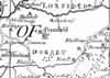 | Part of the 1 inch to 1 mile map of Sussex produced in 1724 by Richard Budgen | Frantfield | ||
| 1763 | ![A New Map of [North] Sussex](images/t/Kitchin1763E.jpg) | A New Map of [North] Sussex by Thomas Kitchin | Frantfield | Thomas Kitchin | |
| Thomas Kitchin, an engraver and publisher from c.1738 to 1776, held the appointment of Hydrographer to the King. His output was prolific. He engraved the maps of the British and French dominions in North America by John Mitchell (1755), which was used at the peace coucil at the end of the revolutionary war. In his later years he worked with his son (hence senior after his name in the c.1755 edition of the Small English Atlas). He died in 1784. | |||||
| 1st Sep 1787 | ![[North] Sussex](images/t/Cary1787E.jpg) | [North] Sussex by John Cary | Frantfield | John Cary | |
| John Cary, apprenticed to William Palmer in 1770, went into business in 1783 as a publisher of maps, plans and road-books. He was highly successful and is referred to as the founder of the modern English School of Cartography by H.G. Fordham | |||||
| c 1795 | 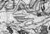 | Part of the 1 inch to 1 mile map of Sussex produced in 1795 by William Gardner and Thomas Gream | Frantfield | ||
| c 1825 | 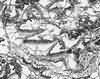 | Part of the 1 inch to 1 mile map of Sussex produced in 1825 by Christopher and John Greenwood | Framfield | ||
| 1837 | ![[North] Sussex](images/t/Moule1837E.jpg) | [North] Sussex by Thomas Moule | Framfield | Thomas Moule | |
| Thomas Moule was a bookseller. He published a number of important works on heraldry and antiquities, including Bibliotheca heraldica Brittaniae in 1822. The English Counties delineated; or, a topographical description of England has a complete series of county maps and was published by Thomas Moule in 1837 | |||||
| 1840 | ![[North] Sussex](images/t/Dugdale1840E.jpg) | [North] Sussex by Joshua Archer, Pentonville, London | Framfield | Dugdale | |
| Dugdale's England and Wales Delineated | |||||
| 6th Jun 1841 | Census | Framfield | 1841 Census Framfield, Sussex | ||
| Commencing at Brookhouse taking the road leading to High Cross, Teeling Common, Pale House Common and Arches, and all that part of the Parish lying on the South side of the Turnpike Road leading from East Bourne to Uckfield. Enumerator - Copping Boorman; Registrar - Henry Holman | |||||
| 6th Jun 1841 | Census | Framfield | 1841 Census Framfield, Sussex | ||
| That part of the parish commencing at Church Style, taking the road to Langhurst Oak and Stone Bridge, Barnet Wood, Honeys Green, Easons Green and terminating at New Place Enumerator - George Brooker; Registrar - Henry Holman | |||||
| 6th Jun 1841 | Census | Framfield | 1841 Census Framfield, Sussex | ||
| Commencing at Framfield Street taking the road to Birdcage, comprising Hempstead, Highlands, Streele, Watermans, Little Streele, Scantlings Common, Hundred House, Tickerage Mill, Tickerage, Gatehouse and terminating at W. Hill near the Sussex Rocks. Enumerator - James Waller; Registrar - Henry Holman | |||||
| 6th Jun 1841 | Census | Framfield | 1841 Census Framfield, Sussex | ||
| Commencing at Poltrow, comprising Black Boys Common, Pounsley, from thence to Cornwells Nursery taking all that part of the parish situated in and North of the road leading from Pounsley to Possingworth following the turnpike road leading from Cross in Hand to Stone Bridge Gate as far as Bunces occupied by Thos. Weaver. Enumerator - J. Bradford; Registrar - Henry Holman | |||||
| 1851 | Directory | Framfield | Post Office Directory | ||
| FRAMFIELD is a parish 2 miles south-east from Uckfield, and 43 from London, in the Hundred of Loxfield, Dorset, rape of Pevensey, and Union of Uckfield. ......... The number of acres is 6,830, assessed at £5,389 ; the population, by the last returns of 1841, was 1,484 inhabitants. .............. | |||||
| 30th Mar 1851 | Census | Framfield | 1851 Census Framfield, Sussex | ||
| Framfield Parish. Framfield Street District. All that part of the Parish of Framfield comprising all the house in the village. Framfield Place following the Uckfield road to Bird Nye and Hempstead, Great and Little Streele, Scantlings Common, Hundred House, Pound House, Tickerage, Gate House, Old Work House and terminating at the National School. Enumerator - Charles Brooker, age 30 years, Cordwainer, Framfield Street. | |||||
| 30th Mar 1851 | Census | Framfield | 1851 Census Framfield, Sussex | ||
| Framfield Parish. Eastern District. Commencing at Church Style including all that part of the Parish situated between the high road leading from Church Style to Stone Bridge, and the turnpike road leading from Mount Ephraim Gate to the Nursery in the Parish of East Hoathly, comprising Barnett Wood, Easons Green and Pale House Common, terminating at Ashes Farm and Brook House. Enumerator - George Brooker, Cordwainer, Framfield Street. | |||||
| 30th Mar 1851 | Census | Framfield | 1851 Census Framfield, Sussex | ||
| Framfield Parish. Blackboys District. Comprises all that part of the Parish of Framfield on the north side of the High Road leading from Kettlesdown to Stonebridge commencing at Lankhurst Oak and including Blackboys Common, Pounsley, the Common adjoining Cornwell's Nursery, then following the Turnpike Road to the Blackboy Inn and terminating at Stonebridge House. Enumerator - George Garrett, Surveyor of the Highways, Pounsley, Framfield. | |||||
| 30th Mar 1851 | Census | Framfield | 1851 Census Framfield, Sussex | ||
| All that part of the Parish of Framfield which lies on the South Western side of the Turnpike Road leading from Uckfield to East Hoathly, commencing at Teelings Common and terminating at Tarble Down including Broyle Cottage, Bentley Farm and Coopers Hatch. Enumerator - Thomas Bourner. | |||||
| 30th Mar 1851 | Census | Framfield | 1851 Census Waldron, Sussex | ||
| Framfield Parish. South District. All that part of the Parish that lies on the South side of the high road leading from Black Boys to Horeham as far as Hooks Farm including all the houses adjoining that road, likewise all those comprising the village of Waldron. Enumerator - Harry Hassell, Grocer, Waldron Village. | |||||
| 30th Mar 1851 | Census | Framfield | 1851 Census Waldron, Sussex | ||
| Framfield Parish. Middle district. Commencing at the Brook following the high road to Burnt Oak Green, Saunders Mill and to the stream on the Southern side of the Hamlet of Little London, from thence to the White House and to the houses situated on the South side of the New Pond, next taking the high road as far Cross in Hand toll gate, returning by Belle View, Waldron Down and following the high road to Siggs Farm and terminating at the Post Office. Enumerator - John Unstead, Wheelwright, Waldron Street | |||||
| 30th Mar 1851 | Census | Framfield | 1851 Census Waldron, Sussex | ||
| Framfield Parish. North District. Commencing at Waldron Corner and following the high road at Horeham Toll Gate and as far as Woodgate's Cottage, Horeham Flat, from thence to Little London, Waldron, Thorns, Herrings Farm and terminating at the Toll Gate Cross in Hand. Enumerator - Peter Gosling | |||||
| 1867 | Directory | Framfield | Post Office Directory | ||
| FRAMFIELD is a parish, a mile and a half south-east from Uckfield, and 43 miles from London by road, in the Eastern division of the county, hundred of Loxfield Dorset, Pevensey rape, Uckfield union, Lewes county court district and archdeaconry, diocese of Chichester, and rural deanery of South Mailing. ................. The number of acres is 6,700; the population in 1861 was 1,355. .............. | |||||
| 1874 | Directory | Framfield | Post Office Directory | ||
| FRAMFIELD is a large parish, a mile and half southeast from Uckfield and 43 miles from London by road, in the Eastern division of the county, hundred of Loxfield Dorset, Pevensey rape, Uckfield union, Lewes county court district diocese of Chichester, archdeaconry of Lewes, and rural deanery of South Mailing. ............ The number of acres is 6,700; gross estimated rental, £7,756; rateable value, £6,430 ; and the population in 1871 was 1,521. ............... | |||||
| 3rd Apr 1881 | Census | Framfield | 1881 Census Framfield, Sussex | ||
| The village of Framfield | |||||
| 3rd Apr 1881 | Census | Framfield | 1881 Census Framfield, Sussex | ||
| That part of Framfield Parish lying South of Framfield and including High Cross and Pale House Common | |||||
| 3rd Apr 1881 | Census | Framfield | 1881 Census Framfield, Sussex | ||
| That part of Framfield Parish called Pounsely, Waldron Down and Blackboys | |||||
| 1882 | Directory | Framfield | Kelly's Directory | ||
| FRAMFIELD is a large parish and village a mile and a half south-east from Uckfield, 8 north-east from Lewes and 43 miles from London by road, in the Eastern division of the ,county, hundred of Loxfield Dorset, Pevensey rape, Uckfield union, Lewes county court district, diocese of Chichester, archdeaconry of Lewes and rural deanery of Pevensey, No. 3. .......... The area is 6,700 acres : rateable value, £7,982 ; and the population in 1881 was 1,527, .......... | |||||
| 1888 |  | Brooker's 1888 Guide and Directory of Framfield | Brooker's Guide | ||
| c 1899 | 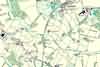 | Part of the 6 inch to 1 mile map of Sussex produced in 1899 by Ordnance Survey | Framfield | ||
The Weald is at Database version 14.05 which has ongoing updates to the 395,000 people; 9,000 places; 613 maps; 3,308 pictures, engravings and photographs; and 248 books loaded in the previous version


