
| Historical notes about Frant |
| c 1100 | History | Frant | Eeles' Frant | ||
| After William II had granted the Lordship of Rotherfield to Richard de Clare, the latter was succeeded by his son Gilbert who thereupon "granted and willingly confirmed … to the Church of St Andrew the Apostle of Rocicestre and the monks serving God in that place, the Church of Rotherfeilde with the Chapel of Frant …" | |||||
| 1296 | Subsidy/tax list | Frant | Pullein's Rotherfield | ||
| The Fernthe [Frant] Subsidy (Tax list) of 1296 in the Hundred of Retherfeld | |||||
| 1327 | Subsidy/tax list | Frant | Pullein's Rotherfield | ||
| The Fernthe [Frant] Subsidy (Tax list) of 1327 in the Hundred of Retherfeld | |||||
| 1332 | Subsidy/tax list | Frant | Pullein's Rotherfield | ||
| The Fernthe [Frant] Subsidy (Tax list) of 1332 in the Hundred of Retherfeld | |||||
| 1349 | History | Frant | Eeles' Frant | ||
| In 1349, Robert de Bromfeld was still holding the Manor of Frant … | |||||
| 1399 | History | Frant | Eeles' Frant | ||
| Sir William Brenchesle purchsed the Manor [of Frant] from Roger Isle, but another record sets out differently … | |||||
| 1430 | History | Frant | Eeles' Frant | ||
| John and William Darell, John Waller and others purchased from William Durant and his wife Agnes, the Manor of Frant | |||||
| 1530 | History | Frant | Eeles' Frant | ||
| William Waller was then the Lord [of the Manor] | |||||
| 1603 | History | Frant | Eeles' Frant | ||
| by the sale of the Manor by Sir Thomas Waller to Anne Offley, widow, the two hundred year connection of his family with Frant was severed. | |||||
| 1610 | ![[North] Sussex](images/t/Speed1610E.jpg) | [North] Sussex by John Norden and augmented by John Speed | Farat | John Speed | |
| The first engraved maps of the counties of Great Britain were the work of Christopher Saxton who, under the authority of the Privy Council, surveyed the English counties in Elizabethan times, from 1574 to 1578. In 1593 he was followed by John Norden who projected an ambitious scheme for a complete series of county histories. He published before his death a number of counties - Middlesex, Hertfordshire, Essex, Northampton, Cornwall, Sussex and Surrey. John Speed's map of Sussex is based upon Norden's map and was engraved by Jodocus Hondius. It occupies pages nine and ten of John Speed's Atlas entitled "The Theatre of the Empire of Great Britaine", is 20 1/4 inches by 15 1/4 inches in size and shows additionally an interesting plan of Chichester and a spirited representation of the Battle of Hastings. | |||||
| 1634 | History | Frant | Eeles' Frant | ||
| John Baker who, with Edward Honeywood, in 1634, became Lord of the Manors of Frant and Sunninglye was descended from a certain John Baker of Battle who flourished in the reign of King Edward III | |||||
| 1645 | ![[North] Sussex](images/t/Blaeu1645E.jpg) | [North] Sussex by Jan Blaeu | Farat | Jan Blaeu | |
| 1655 | History | Frant | Eeles' Frant | ||
| Thomas Baker sold the Manor to William Dyke | |||||
| 1695 | ![[North] Sussex](images/t/Morden1695E.jpg) | [North] Sussex by Robert Morden | Faret | Robert Morden | |
| Robert Morden was a London bookseller from 1669 until his death in 1703. He specialised in the geographical field and was himself something of a cartographer and a publisher. Throughout the 17th and most of the 18th centuries, there was little distinction between the activity of book or print-selling and that of publishing: many booksellers were also printers or engravers. They undertook the sale of each others' work and often combined to meet the high cost of publishing a new map or reissue of an old atlas, even if the original plates were still available. This map was published in Brittania: a chorographical description of Great Britain and Ireland by William Camden. | |||||
| c 1700 | History | Frant | Eeles' Frant | ||
| Mrs Hutton [granddaughter of William Dyke] inherited the Lordship of Frant | |||||
| c 1724 | 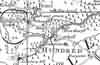 | Part of the 1 inch to 1 mile map of Sussex produced in 1724 by Richard Budgen | Frant | ||
| 1763 | ![A New Map of [North] Sussex](images/t/Kitchin1763E.jpg) | A New Map of [North] Sussex by Thomas Kitchin | Frant | Thomas Kitchin | |
| Thomas Kitchin, an engraver and publisher from c.1738 to 1776, held the appointment of Hydrographer to the King. His output was prolific. He engraved the maps of the British and French dominions in North America by John Mitchell (1755), which was used at the peace coucil at the end of the revolutionary war. In his later years he worked with his son (hence senior after his name in the c.1755 edition of the Small English Atlas). He died in 1784. | |||||
| 1st Sep 1787 | ![[North] Sussex](images/t/Cary1787E.jpg) | [North] Sussex by John Cary | Frant | John Cary | |
| John Cary, apprenticed to William Palmer in 1770, went into business in 1783 as a publisher of maps, plans and road-books. He was highly successful and is referred to as the founder of the modern English School of Cartography by H.G. Fordham | |||||
| c 1795 | 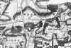 | Part of the 1 inch to 1 mile map of Sussex produced in 1795 by William Gardner and Thomas Gream | Frant | ||
| 1808 | ![[North] Sussex](images/t/Cole1808E.jpg) | [North] Sussex by G.Cole and engraved by J.Roper | Frant | G. Cole | |
| The British atlas; comprising a series of county maps…intended to illustrate and accompany 'The beauties of England and Wales' published 1808. | |||||
| 1810 | History | Frant | Eeles' Frant | ||
| Since 1810 the lordhip of the Manor of Frant has remained in the hands of the Camden family | |||||
| 31st Aug 1823 | Diary entry | Frant | Cobbett's Rural Rides | ||
| Here I am after a most delightful ride of twenty-four miles through Frant, Lamberhurst, Goudhurst, Milkhouse-Street, Benenden, and Rolvenden. By making a great stir in rousing waiters and "boots" and maids, and by leaving behind me the name of "a - noisy, troublesome fellow," I got clear of "the Wells," and out of the contagion of its Wen-engendered inhabitants, time enough to meet the first rays of the sun, on the hill that you come up in order to get to Frant, which is a most beautiful little village at about two miles from "the Wells." Here the land belongs, I suppose, to Lord Abergavenny, who has a mansion and park here. A very pretty place, and kept, seemingly, in very nice order. I saw here what I never saw before : the bloom of the common heath we wholly overlook ; but, it is a very pretty thing; and here, when the plantations were made, and as they grew up, heath was left to grow on the sides of the roads in the plantations. The heath is not so much of a dwarf as we suppose. This is four feet high; and, being in full bloom, it makes the prettiest border that can be imagined. This place of Lord Abergavenny is, altogether, a very pretty place; and, so far from grudging him the possession of it, I should feel pleasure at seeing it in his possession, and should pray God to preserve it to him, and from the unholy and ruthless touch of the Jews and jobbers; but, I cannot forget this Lord's sinecure! | |||||
| c 1825 | 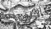 | Part of the 1 inch to 1 mile map of Sussex produced in 1825 by Christopher and John Greenwood | Frant | ||
| 1837 | ![[North] Sussex](images/t/Moule1837E.jpg) | [North] Sussex by Thomas Moule | Frant | Thomas Moule | |
| Thomas Moule was a bookseller. He published a number of important works on heraldry and antiquities, including Bibliotheca heraldica Brittaniae in 1822. The English Counties delineated; or, a topographical description of England has a complete series of county maps and was published by Thomas Moule in 1837 | |||||
| 1840 | ![[North] Sussex](images/t/Dugdale1840E.jpg) | [North] Sussex by Joshua Archer, Pentonville, London | Frant | Dugdale | |
| Dugdale's England and Wales Delineated | |||||
| 6th Jun 1841 | Census | Frant | 1841 Census Frant, Sussex | ||
| Down Lane District, comprises so much of the Parish as lies between Mayfield and Wadhurst roads as boundaries. Enumerator Henry Dibley and Registrar John Micklefield | |||||
| 6th Jun 1841 | Census | Frant | 1841 Census Frant, Sussex | ||
| Henley Mill District, comprises so much as lies between the Wadhurst Road and the Lamberhurst Road as boundaries. Enumerator Richard Fulljames and Registrar John Micklefield | |||||
| 6th Jun 1841 | Census | Frant | 1841 Census Frant, Sussex | ||
| Bayham District Comprises So Much As Lies Between The Lamberhurst & Dundall Roads As Boundaries. Enumerator Thomas Jemmett and Registrar John Micklefield | |||||
| 6th Jun 1841 | Census | Frant | 1841 Census Frant, Sussex | ||
| Bells Yew District comprises so much as lies between Dundall Road and road leading from Bush Houses to Tutty's Village. Enumerator Stephen Hickmott and Registrar John Micklefield | |||||
| 6th Jun 1841 | Census | Frant | 1841 Census Frant, Sussex | ||
| Tutty's District comprises so much as lies between the road leading from the Bush Houses to Tutty's and the road leading to Tunbridge Wells. Enumerator Obed Wickens and Registrar John Micklefield | |||||
| 6th Jun 1841 | Census | Frant | 1841 Census Frant, Sussex | ||
| Eridge Park District comprises so much as lies between the Mayfield Road and the road leading from Frant Village to Eridge Village. Enumerator John Hooker and Registrar John Micklefield | |||||
| 6th Jun 1841 | Census | Frant | 1841 Census Frant, Sussex | ||
| Frant District comprises so much as lies between Eridge Park and Shernfold Park, the Wells Road and Case Woods as bourdaries. Enumerator E. W. Gilbert and Registrar John Micklefield | |||||
| 6th Jun 1841 | Census | Frant | 1841 Census Tunbridge Wells, Kent & Frant, Sussex | ||
| Broadwater District comprises so much as lies between Eridge Road and Wells Road and boundary of Parish as boundaries. Enumerator Robert Hooker and Registrar John Micklefield | |||||
| 6th Jun 1841 | Census | Frant | 1841 Census Tunbridge Wells, Kent & Frant, Sussex | ||
| Tunbridge Wells and Wells Road District comprises so much as lies between the boundaries of No 5 and No 8 Districts and boundary of Parish. Enumerator F. K. Jacob and Registrar John Micklefield | |||||
| 1851 | Directory | Frant | Post Office Directory | ||
| FRANT is a village two miles and a half from Tunbridge Wells, situated partly in both of the counties of Kent and Sussex, on the brow of a hill, in the Hundred of Rotherfield, rape of Pevensey, and Ticehurst Union. ...... The area is 8,745 acres, and the population 2,280, of which 483 is in the town of Tunbridge Wells. The Income Tax assessment, in 1842; was £10,797 ............... | |||||
| 30th Mar 1851 | Census | Frant | 1851 Census Frant, Sussex | ||
| Down Lane District. All that part of the Parish towards the South and South East lying between the Mayfield and Wadhurst Turnpike Roads and the outbounds of the Parish including both sides of such Roads and taking Frederic Hickmott's in Eridge Park by Mayfield Road, and John Wickens at the old Brickyard and Mrs Sheffield Grace's by Wadhurst Road also commencing at the first House below the Turnpike Gate House. Enumerator - Henry Dibley | |||||
| 30th Mar 1851 | Census | Frant | 1851 Census Frant, Sussex | ||
| Henly District. All that part of the parish towards the east as lies between the Wadhurst Road District (omitting the old Brickyard and Knole) and the Lamberhurst Road and outbounds of the Parish including both sides of the Road from Bayham to Bells Yew. Enumerator - Richard Fulljames | |||||
| 30th Mar 1851 | Census | Frant | 1851 Census Frant, Sussex | ||
| Bells Yew District. All that part of the Parish as lies on the left of the Lamberhurst Road to Bells Yew including Bells Yew (except the right hand side of Lamberhurst Road included in Henly District) thence to Little Bayham, including Carpenter's House there, and taking in Tinkers Gate, Diamonds, Rushly and Courtlodge. Enumerator - Richard Carr | |||||
| 30th Mar 1851 | Census | Frant | 1851 Census Frant, Sussex | ||
| Dundale District. All that part of the parish as lies between the Bells Yew District and outbounds of the Parish to Tutty's Village or Hawkenbury and the Hastings Railway to the Bush Houses taking in Bush Houses, Tuttys, Bayham Abbey and Lodge and Tollseye. Enumerator - Stephen Hickmott | |||||
| 30th Mar 1851 | Census | Frant | 1851 Census Frant, Sussex | ||
| Wells Road & Forest District. All that part of the parish as lies along the Wells Road on both sides to the Gate leading into Jessups (taking in T. Sales, J. Bakers and S. Martins) from Jessup's Gate to the Reservoir along the Road to Halls Hole as far as the Hastings line of Railway taking only the right hand side of the Road from Reservoir to Whybournes Gate and taking in all the Forest on the West side of Railway. Enumerator - Obed Wickens | |||||
| 30th Mar 1851 | Census | Frant | 1851 Census Frant, Sussex | ||
| Eridge District. All that part of the parish taking in Eridge, The Keepers House in park (David Hickmotts), Sharps Porters Lodge, Richardson's ditto thence to late Hamilton Daveys thence to Eridge Turnpike Road and taking the left of such Road to Eridge. Enumerator - John Hooker | |||||
| 30th Mar 1851 | Census | Frant | 1851 Census Frant, Sussex | ||
| Broadwater District. All that part of the Parish as lies between the Eridge District the outbounds of the Parish and the Eridge Roads taking both sides of such Road from Neals House (including) Strawberry hill to the Parish boundary beyond Ropers Gate. Enumerator - Robert Hooker | |||||
| 30th Mar 1851 | Census | Frant | 1851 Census Frant, Sussex | ||
| Frant District. All that part of the Parish as lies between the Eridge Park District, Down Lane, Henly, Bells Yew and Wells Road Districts Comprising the Village of Frant. Enumerator - Frederic K Jacob | |||||
| 30th Mar 1851 | Census | Frant | 1851 Census Frant, Sussex | ||
| Tunbridge Wells District (part of the Town of Tunbridge Wells). All that part of the Parish as lies between the Boundary of the Local Act District from Whyborns Gate to Hargate Lodge and Folly, Brewhouse commencing at Whyborns Gate following such Boundary taking the Houses on left hand side of Road to Jessups on the Forest thence to Hargate Lodge and thence to Parish boundary at Folly and the Brewhouse including all the intermediate space and thence back to Whyborns Gate. Enumerator - Willim Jackman | |||||
| 1864 | 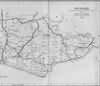 | East Sussex with the addition of the Railways by Mark Antony Lower | Frant | Lower's Sussex | |
| Mark Antony Lower, son of Richard Lower, born 14th July 1813 in Heathfield, school master in the early 1830s at East Hoathly, Heathfield and Alfriston; and at Lewes from 1835 to 1867; and at Seaford 1867-1871. He then moved to London where he died in 1876. He was a founder member of the Sussex Archeological Society and a prolific contributor to the collections of the society. He published
| |||||
| 1867 | Directory | Frant | Post Office Directory | ||
| FRANT is a village, parish, and railway station, 2 1/2, miles from Tunbridge Wells, on the brow of a hill, and is partly in Kent and partly in the Eastern division of Sussex, hundred of Rotherfield, rape of Pevensey, Ticehurst union, Tunbridge Wells county court district, diocese of Chichester, and archdeaconry of Lewes. ................. The area is 8,745 acres, and the population in 1861 was 2,469, of which 483 are in the town of Tunbridge Wells. ............ | |||||
| 1874 | Directory | Frant | Post Office Directory | ||
| FRANT is a village, parish, and station on the Hastings branch of the South Eastern Railway, 2 1/2 miles south from Tunbridge Wells, on the brow of a hill, on the road to Hastings, and is partly in Kent and partly in the Eastern division of Sussex, in the hundred of Rotherfield, rape of Pevensey, Ticehurst union, Tunbridge Wells county court district, diocese of Chichester, archdeaconry of Lewes, and rural deanery of Withyham. ............... The area is 9066 acres, of which 411 are in Kent; gross estimated rental, £21,774; rateable value, £17,320, and the population in 1871 was 3,263, of which 314 are in Kent; of the Sussex portion 1,100 are in Tunbridge Wells. ................ | |||||
| c 1875 | 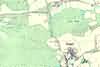 | Part of the 6 inch to 1 mile map of Sussex produced in 1875 by Ordnance Survey | Frant | ||
| 3rd Apr 1881 | Census | Frant | 1881 Census Frant, Sussex | ||
| The village of Frant | |||||
| 3rd Apr 1881 | Census | Frant | 1881 Census Frant, Sussex | ||
| That part of Frant Parish lying North West of Frant and South West of Broadwater Down | |||||
| 3rd Apr 1881 | Census | Frant | 1881 Census Frant, Sussex | ||
| That part of Frant Parish lying South of Frant | |||||
| 3rd Apr 1881 | Census | Frant | 1881 Census Frant, Sussex | ||
| Bells Yew Green | |||||
| 3rd Apr 1881 | Census | Frant | 1881 Census Frant, Sussex | ||
| That part of Frant Parish lying North East of Frant and South East of Broadwater Down | |||||
| 3rd Apr 1881 | Census | Frant | 1881 Census Frant, Sussex | ||
| That part of Frant Parish lying next to Eridge Park | |||||
| 3rd Apr 1881 | Census | Frant | 1881 Census Frant, Sussex | ||
| Broadwater Down (East) | |||||
| 3rd Apr 1881 | Census | Frant | 1881 Census Frant, Sussex | ||
| Broadwater Down (West) | |||||
| 3rd Apr 1881 | Census | Frant | 1881 Census Frant, Sussex | ||
| Hawkenbury | |||||
| 1882 | Directory | Frant | Kelly's Directory | ||
| FRANT is a village, parish and station on the Hastings and Tunbridge branch of the South Eastern railway, 2 1/2 miles south from Tunbridge Wells, on the brow of a hill, on the road to Hastings, and is partly in Kent and partly in the Eastern division of Sussex, in the hundred of Rotherfield, rape of Pevensey, Ticehurst union, Tunbridge Wells county court district, diocese of Chichester, archdeaconry of Lewes and rural deanery of Pevensey fourth division. .............. The area is 9,066 acres, of which 411 are in Kent ; rateable value, £28,179, and the population in 1881 was 3,481, of which 314 are in Kent; of the Sussex portion, 1,100 are in Tunbridge Wells. ............ | |||||
The Weald is at Database version 14.05 which has ongoing updates to the 395,000 people; 9,000 places; 613 maps; 3,308 pictures, engravings and photographs; and 248 books loaded in the previous version


