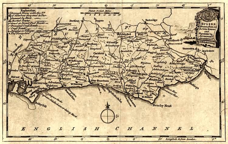
The Weald of Kent, Surrey and Sussex
Sussex by Thomas Kitchin - 1750Source: Thomas Kitchin
Thomas Kitchin, an engraver and publisher from c.1738 to 1776, held the appointment of Hydrographer to the King. His output was prolific. He engraved the maps of the British and French dominions in North America by John Mitchell (1755), which was used at the peace coucil at the end of the revolutionary war. In his later years he worked with his son (hence senior after his name in the c.1755 edition of the Small English Atlas). He died in 1784.
for more information refer to Printed Maps of Sussex, 1575-1900 by D. Kingsley, published by the Sussex Record Society
and visit Old Sussex Mapped: Two centuries of Sussex County Maps researched by the Department of Geography, University of Portsmouth, UK.
Sussex by Thomas Kitchin - 1750

 
More about
Bolbrook
Broadhurst
Buckhurst
Burwash
Buxtead
Chailey
Dalling
Danehill Street
E. Hoathly
East Grinsted
Eridge
Eridge Park
Forrest Row
Lit. Horstead
Mayfield
Newick
Rotherfield
Tunbridge Wells
Tyshurst
Uckfield
Wadhurst
Waldron
Withyham

The Weald is at  Database version 14.05 which has ongoing updates to the 395,000 people; 9,000 places; 613 maps; 3,308 pictures, engravings and photographs; and 248 books loaded in the previous version

ODNB  
British Libarary  
High Weald  
Sussex Record Society  
Sussex Archaeological Society  
Kent Archaeological Society  
Mid Kent Marriages  
Ancestry  
Genes Reunited  
International Genealogical Index  
National Archives  

Top
of the
page